According to NASA, 2024 recorded the warmest average earth temperature with global temperatures of 2.30 degrees Fahrenheit. Warmer temperatures, caused by greenhouse gas emissions (GHGs) and other climate changes, are altering weather patterns leading to severe storms, increased droughts and rising oceans. These extreme weather events pose risks to human life, such as food insecurity, health risks and poverty and displacement.
Researchers and scientists around the world are using geographic information system (GIS) to gather data to study the associations between warming temperatures and weather conditions. Findings can be used to predict future changes and implement climate adaptation and mitigation strategies to reduce the impact of weather shocks. The UN recognises GIS as a key tool to measure and monitor the progress in achieving UN Sustainable Development Goals (SDGs), including those related to SDG 13, climate action.
There is a need for experts to work in collaboration to collect data to mitigate climate risks and even more so for data to be open and accessible to support researchers and governments globally to respond to the climate emergency.
Commonwealth Alumnus Blessings Chiepa is the co-founder of the Malawi Chapter of OpenStreetMap (OSM), an organisation that uses free and open-source software tools, collaborative mapping and GIS technologies, to gather geographical data for decision making and a community of practise for those interested in mapping, GIS & Remote sensing in Malawi. Blessings became an active leader of OSM Malawi in 2022 following the completion of his MSc in Geographical Information Management from Cranfield University, funded through a Commonwealth Scholarship.
Blessings is a GIS and remote sensing specialist with expertise in geospatial analysis, spatial data management, data visualisation, and the application of cutting-edge technologies in diverse humanitarian contexts. He is currently a Geospatial Analyst and Researcher at the Malawi Liverpool Wellcome (MLW) Research Programme.
Building a local community of GIS professionals
During his Master’s studies, Blessings was introduced to GIS technology and innovation, a concept that was relatively new in Malawi at the time. He explains that countries across Africa are slow in adopting emerging geospatial technologies, however there is great potential to leverage such technologies to tackle development challenges.
Blessings realised that although some government and humanitarian organisations and academia were using geospatial science to gather data, they were working in isolation. As a result, there was duplication where data had been gathered from the same geographic location, however with a lack of coordination and oversight, this wasn’t realised or addressed to broaden data gathering to wider locations.
Blessings also noticed a lack of opportunities for young people in Malawi to develop skills in geospatial science and that students studying GIS had limited options to practice spatial mapping and data analysis.
To address this gap, in 2022, Blessings took an active leadership role in the Malawi OSM chapter of the global OSM platform with a vision to support GIS and remote sensing professionals and students in Malawi to contribute to this data.
Blessings was not new to the OSM community. Prior to his Master’s studies, he volunteered as a geospatial mapper with the Humanitarian OpenStreetMap Team (HOT) in Malawi, an international OSM team dedicated to humanitarian action and community development through open mapping. Here, he gained experience in conducting social mapping, helping communities get involved in the mapping process and share their knowledge and lived experiences.
 Following his studies, Blessings now co-leads a team of volunteer GIS professionals to collect spatial data, conduct collaborative mapping, train fellow professionals in mapping, exchange knowledge and access data freely from licensed geodata sources. Through his leadership of OSM Malawi, he is building a new community of practice in Malawi and mentoring the next generation of geospatial professionals.
As of 2024, OSM Malawi has a membership of over 200 professionals and students who are gaining and growing their skills in collaborative mapping, GIS and remote sensing, whilst contributing to the wider development goals of the country. The voluntary efforts of mapping and gathering data are now used to support humanitarian agencies and the government to respond to natural disasters and other emergencies.
Blessing shares he could not have achieved this without his Commonwealth Scholarship.
“Attaining a Master’s has given me more confidence in my skills, as well as the ability to make other people more confident in my skills. I believe without this qualification, people would have doubts about my capabilities both, professional and leadership. This has helped me to lead teams of volunteers confidently and deliver impactful results.”
Adopting AI technology model suitable to map local regions
Blessings credits his Master’s for introducing him to computer programming and artificial intelligence (AI). From learning how to write and script computer programmes such as Python to mapping using AI, Blessings now applies these skills to use GIS to inform humanitarian programmes and responses.
His Master’s thesis investigated mapping using AI to address challenges in the sector. One of the biggest challenges to humanitarian and emergency responses in Malawi is the lack of city and household data, which enables effective planning and delivery of responses. Traditional methods of mapping households manually can be a mammoth task for big cities such as Blantyre or Lilongwe and are not always accurate or can become outdated in short period of time.
AI tools available from large tech companies can be used to detect housing infrastructure using satellite images, however such models are mainly trained on data from developed countries. These tools may therefore not be appropriate for use in developing countries like Malawi, where housing infrastructure is different and includes informal settlements, that can be missed in AI mapping exercises.
To overcome this, Blessings created an AI model designed to detect households and buildings in developing countries, recognising local infrastructure and settlement patterns inherent in developing countries.
“With the help of GIS and remote sensing, we can quickly assess the damage using satellite images and volunteer communities to map the region and give a report. That’s a starting point in emergency response.”
Blessings presented his Master’s thesis and model at the State of The Map (SoTM) Africa conference in Cameroon in 2023. He used this platform to call upon professionals and policymakers across Africa to take ownership and build AI classification models to tackle local and national challenges and meet their own development agenda.
Using technology for humanitarian efforts
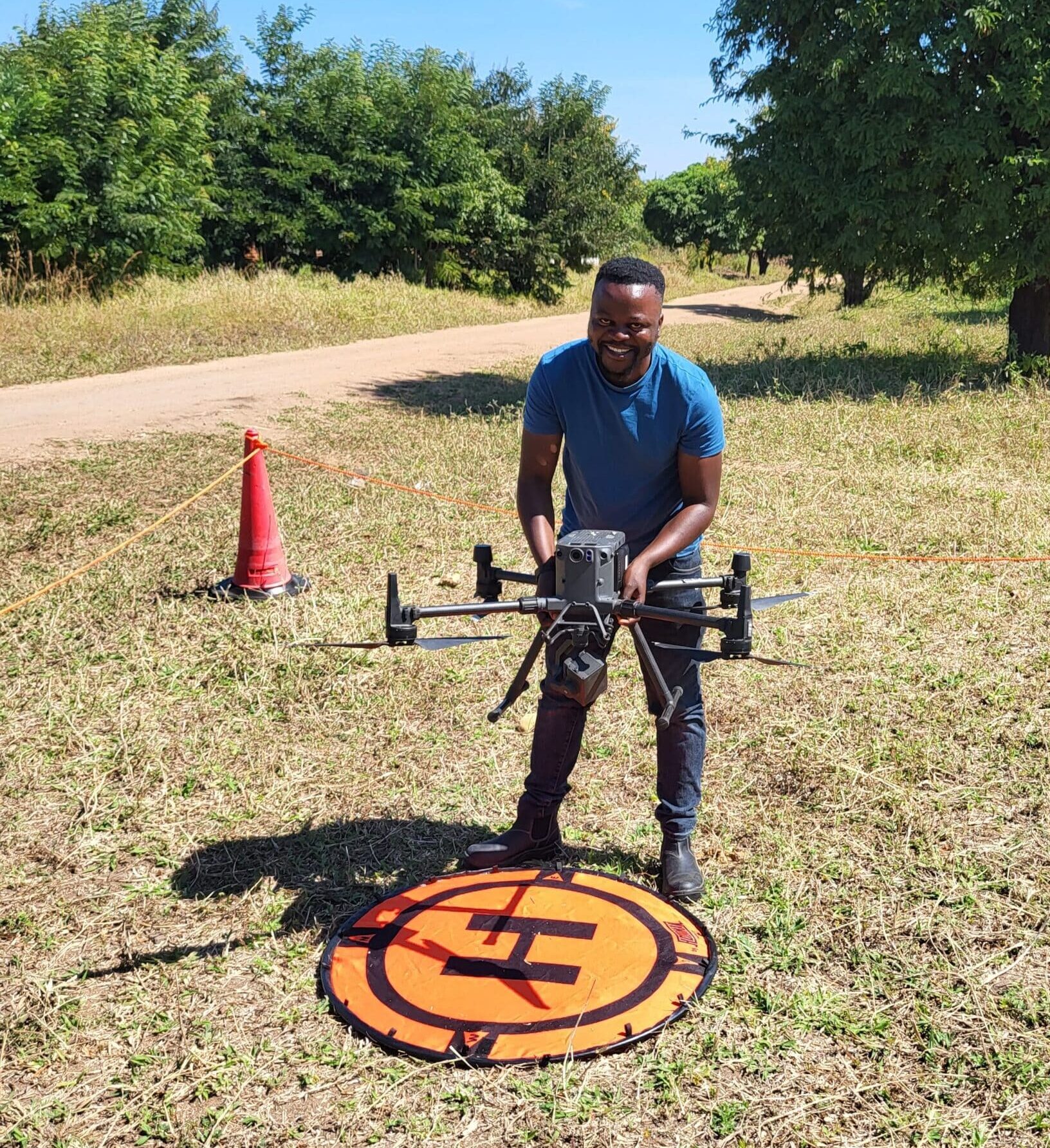
Blessings Chiepa with drone
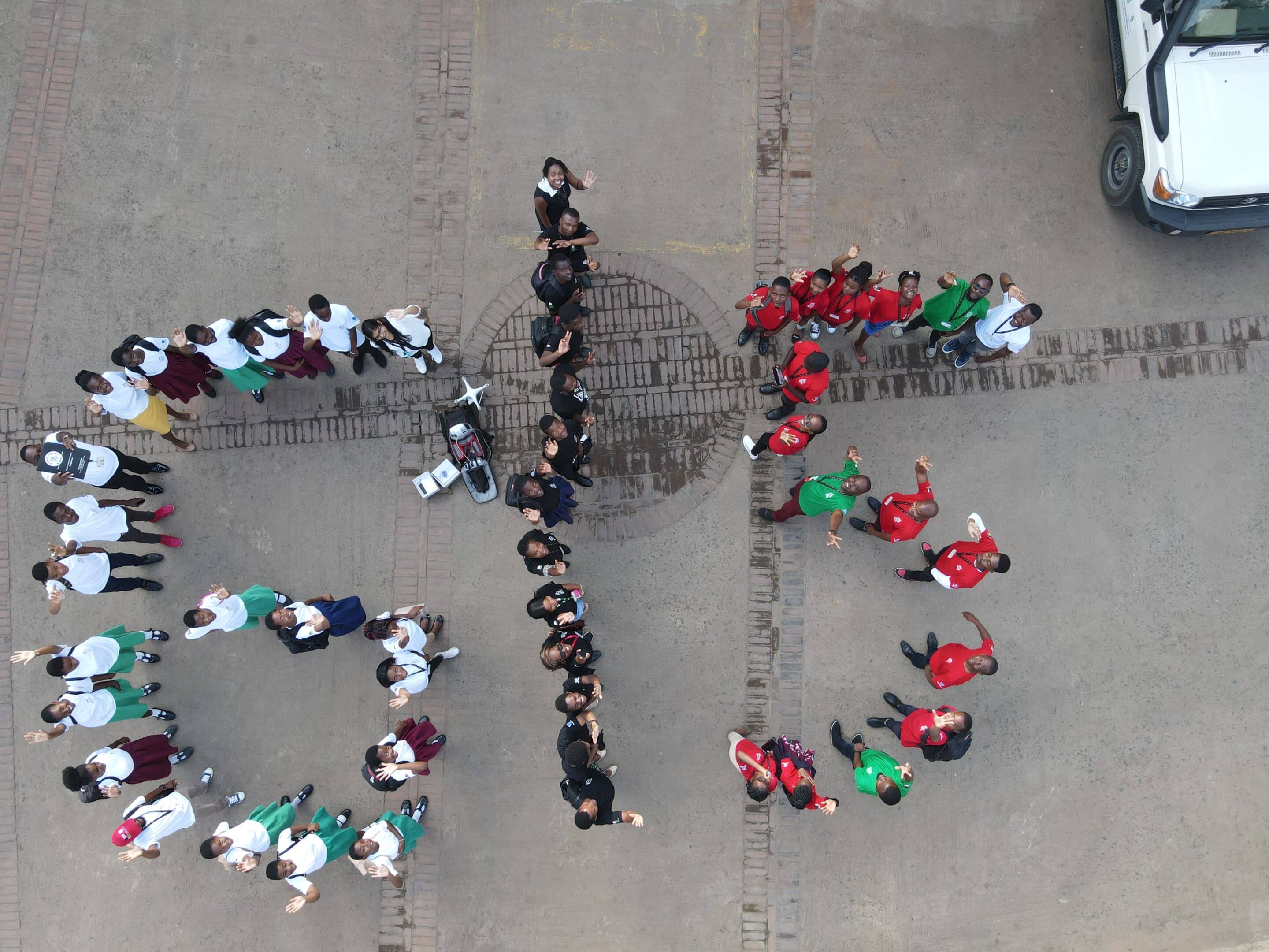
Key to Blessings’ work is his passion for community engagement. In 2022, with the support of MLW, together with his colleagues Patrick Kalonde, Commonwealth Alumnus Chifuniro Baluwa, and Commonwealth Scholar Clinton Nkolokosa, they organised the first GIS Day for students from secondary schools, researchers and professionals to promote multi-sectoral use of GIS technology and inspire students to pursue science and technology for sustainable development.
Under Blessing’s leadership, OSM Malawi has worked with five public universities in Malawi training students to carry out mapping activities to address different challenges in communities.
In 2024, OSM Malawi hosted the first State of The Map (SoTM) Conference in Malawi to discuss and reflect on the state of geospatial sciences in the country. The conference included training workshops and career development talks, and was attended by over 100 GIS professionals, students and entrepreneurs.
“Key stakeholders such as policymakers and government officials, including the National Planning Commission (NPC) responsible to implement the Malawi Vision 2063, were present. One of the recommendations by the NPC was that we [OSM Malawi] create technical working groups for people from various sectors interested in geospatial sciences such as agriculture, health, poverty eradication, and research.
“The conference helped OSM Malawi gain recognition for its efforts in advancing geospatial sciences. As per the recommendation, Blessings implemented and holds monthly meetings of the technical working groups to advance the use of geospatial technology across sectors to achieve sustainable development. Blessings hopes to make the conference an annual event.
“There is now more awareness of the potential of GIS technology in various sectors. This is a result of various activities I have implemented since I came back from the Scholarship.”
Applying skills to real-world challenges
Blessings believes his Commonwealth Scholarship was pivotal in developing his academic and professional skills, including his current PhD research. One of his main achievements was learning about advanced quantitative methods. He is now using this in his PhD research on understanding the impacts of climate change on vector-borne diseases like malaria and schistosomiasis in Chikwawa district, Malawi, where he applies his skills in real-world health challenges, generating data that can inform more effective disease control strategies.
“The exposure I gained whilst in the UK has been a milestone for me. I was exposed to a much broader global perspective of different issues, and this has shaped how I view such issues myself. One good example is how I have become sensitive to issues of climate change, governance and advocacy.
“Before studying in the UK, although I knew about climate change, I was not fully convinced but when I saw how the British are perceiving this issue and its broader impacts on the global environment and economy, I changed my perspectives and even my actions and habits. I am now more considerate of the environment and more likely to support any climate change initiatives than before.”
Blessings Chiepa is a 2021 Commonwealth Shared Scholar from Malawi. He completed an MSc in Geographical Information Management from Cranfield University.