


As a young Pacific Islander, I have always been drawn towards a career that could make a positive impact in disaster risk and climate change. Currently I am pursuing a PhD in Environmental Science using applied Earth observation data to determine the impacts of climate change on the spread of invasive species.
Prior to this and after the completion of my MSc at the University of Leicester, I was employed as a Geographic Information System (GIS) Project Assistant within the Geoscience, Energy and Maritime (GEM) Division in The Pacific Community (SPC), a regional technical and scientific multi-disciplinary organisation focused on improving the wellbeing of Pacific people. In my role, I provided geospatial support across divisional projects which ranged from disaster risk, land use monitoring, and mineral extraction.
Within the GEM Division there are three core programmes, Georesources and Energy, Oceans and Maritime, and Disaster and Community Resilience. Across all programmes it is evident that their work is related to disaster preparedness and climate change, directly or indirectly. Although a disaster programme has been in place for a period, there has been a shift in focus on building capacity in-country in a more sustainable manner, through utilising open-source tools and competency-based training dedicated towards disaster emergency managers and technical officers including surveyors, environmental officers, engineers, and geospatial analysts.
Introducing new analysis tools
As one of the few people in SPC who is trained in GIS and Remote Sensing, I contributed to the development and delivery of training materials which aim to increase the technical skills of professionals in government departments across the Pacific region. Such training prioritises the usage of open-source tools and geospatial data management, and includes basic GIS for disaster management, data management, mapping for decision making, and undertaking geospatial analysis to better inform disaster managers in their planning and response efforts.
Following my Commonwealth Scholarship, I joined my first major project in GEM called the Partner Project, funded by New Zealand MFAT, working with the National Institute of Water and Atmospheric Research (NIWA), which had developed the tool RiskScape, a software application which assesses the socio-economic impact of natural hazards. As part of this project, we were able to introduce the tool in Samoa and Vanuatu to support their disaster planning, focusing on tsunamis, flooding, and earthquakes. A major portion of this project included training and capacity building to successfully implement the tool at a national level which involved the development of a regional training for trainers’ curriculum. This included everything from defining disasters and disaster management, to basic GIS, and building an understanding of hazard model development.
Through the project, two national repositories were deployed in the disaster offices of Samoa and Vanuatu which had gained ministerial and government interest and support as to the importance of this tool and dedicated local human resources to implement and manage the information gained across sectors.
Promoting data-sharing
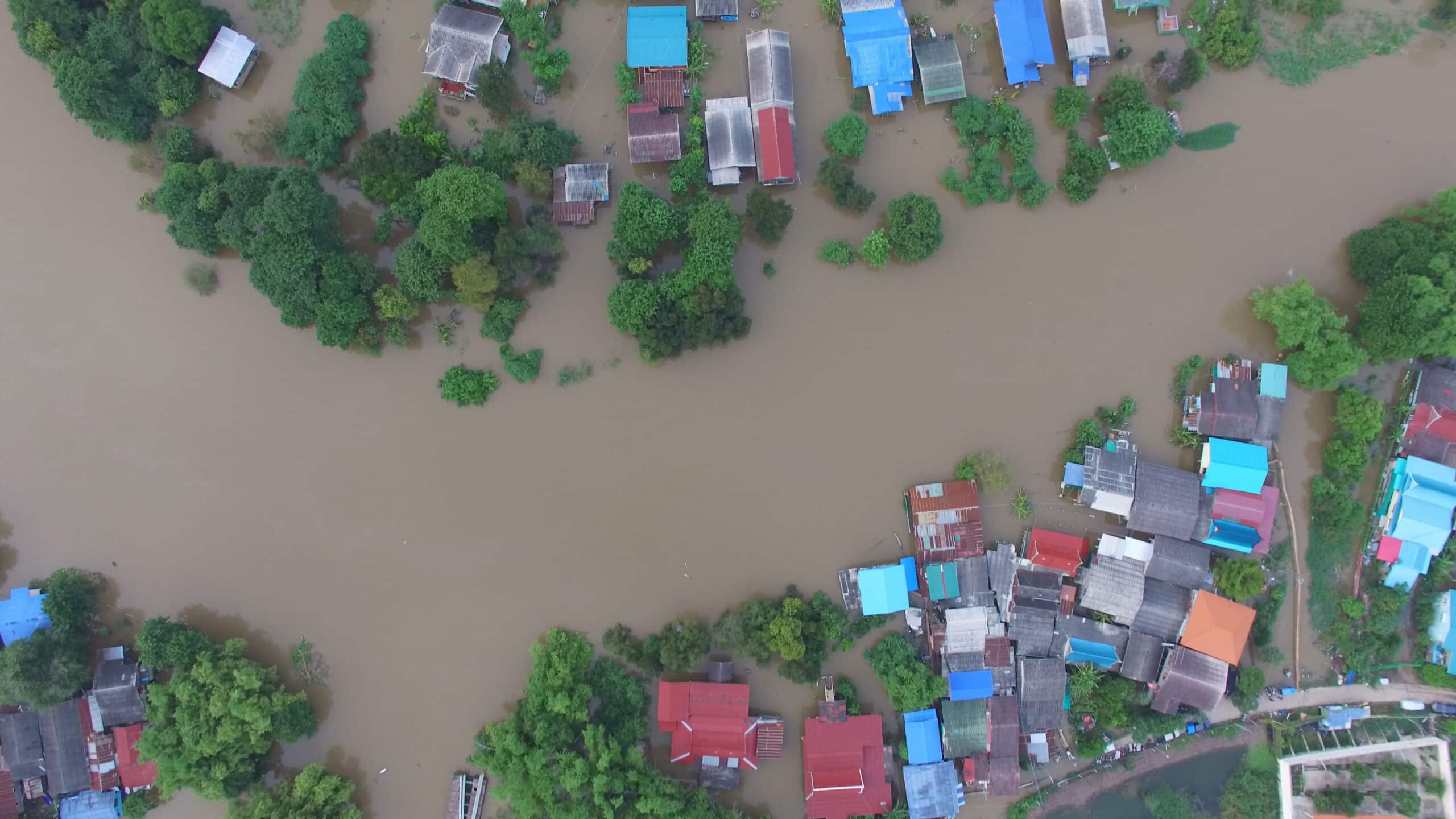
My experience and work have enabled me to successfully influence data-sharing policies within national departments so that there is a greater focus on open data, and so that access to data is prioritised during emergency events. This has resulted in effective decision-making at ministerial levels on the distribution of post-disaster aid and the effective allocation of funding for rehabilitation and recovery. For example, during Tropical Cyclone Gita in Fiji, and Tropical Cyclone Harold in Fiji and Vanuatu, within my role at SPC I provided data mapping and analysis to the National Disaster Management Office to inform relief efforts.
Following this I was a part of a team leading the geospatial data administration for SPCs Ridge to Reef projects’ State of the Coast platform, which is a thematically unique geospatial data management system developed in the Pacific focused on socio-economic, governance, and environmental datasets. The project will centralise country datasets and streamline data collection methods to better support research across the region into areas including water quality and sustainable livelihoods, focused on climate resilience.
A further project, Pacific Catastrophe Risk Assessment and Financing Initiative (PCRAFI), involves the standardising of asset data collection to support quicker analysis in response to disasters, specifically tropical cyclones, and earthquakes, for country level insurance purposes. My role was collaborating to build and maintain a regional-wide geospatial asset data repository called the Pacific Risk Information System (PacRIS), which is crucial to host standardised asset and hazard data generated from the largest field survey exercise in the Pacific. This system and hosted data will contribute to impact forecasting, hazard analysis, and multiple other uses outside of the scope of PCRAFI.
Aside from the work that I do I am an avid supporter of the usage of free and open-source software (FOSS) tools in the Pacific and have been an active volunteer in this space. In late 2020, I was one of three hub managers that convened Fiji’s first hub under the FOSS4G Oceania Conference, and am now the project lead for OpenStreetMap Fiji, which was recently created in March 2021. I see how the geospatial community is valuable to the Pacific for effective decision making in the disaster and climate space and am dedicated towards shifting practitioners’ and decisionmakers’ mindsets towards understanding the value and moving towards the usage of open data and open-source technology. I am also keen to encourage citizens to create data that will support infrastructure monitoring and disaster and climate preparedness through the greater use of technology.