On 25 August 2020, the Africa Regional Certification Commission certified the WHO African Region as wild polio-free after four years without a case. This milestone achievement in five of the six WHO regions marks a further step in achieving global polio eradication, with over 90% of the world’s population now free from the virus. As it stands, there is no cure for polio, however the disease can be prevented through the administration of a simple and effective vaccine.
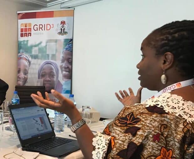
Following the completion of her CSC funded PhD at the University of Southampton, Commonwealth Alumnus, Tracy Adole joined GRID3 (Geo-Referenced Infrastructure and Demographic Data for Development) as an Implementation Manager which required using data to model population dynamics to support vaccine campaigns, including polio in Nigeria.
The GRID3 project, funded by the Bill and Melinda Gates Foundation and United Nations, ran across five countries in Africa, Nigeria, Mozambique, DRC, South Sudan, and Zambia, and aimed to implement population mapping to support capacity strengthening and sustainable development, including vaccination campaigns. On joining the project in Nigeria as an Implementation Manager, Tracy supported the incorporation of grided population data into vaccination campaign which was absent initially.
“The logistics were very poor because what they had were paper maps, people just drawing things, and it wasn’t very accurate. And countries like Nigeria and so many other countries in Africa haven’t done any recent census. And to do a census, it would require a lot of planning, a lot of money.”
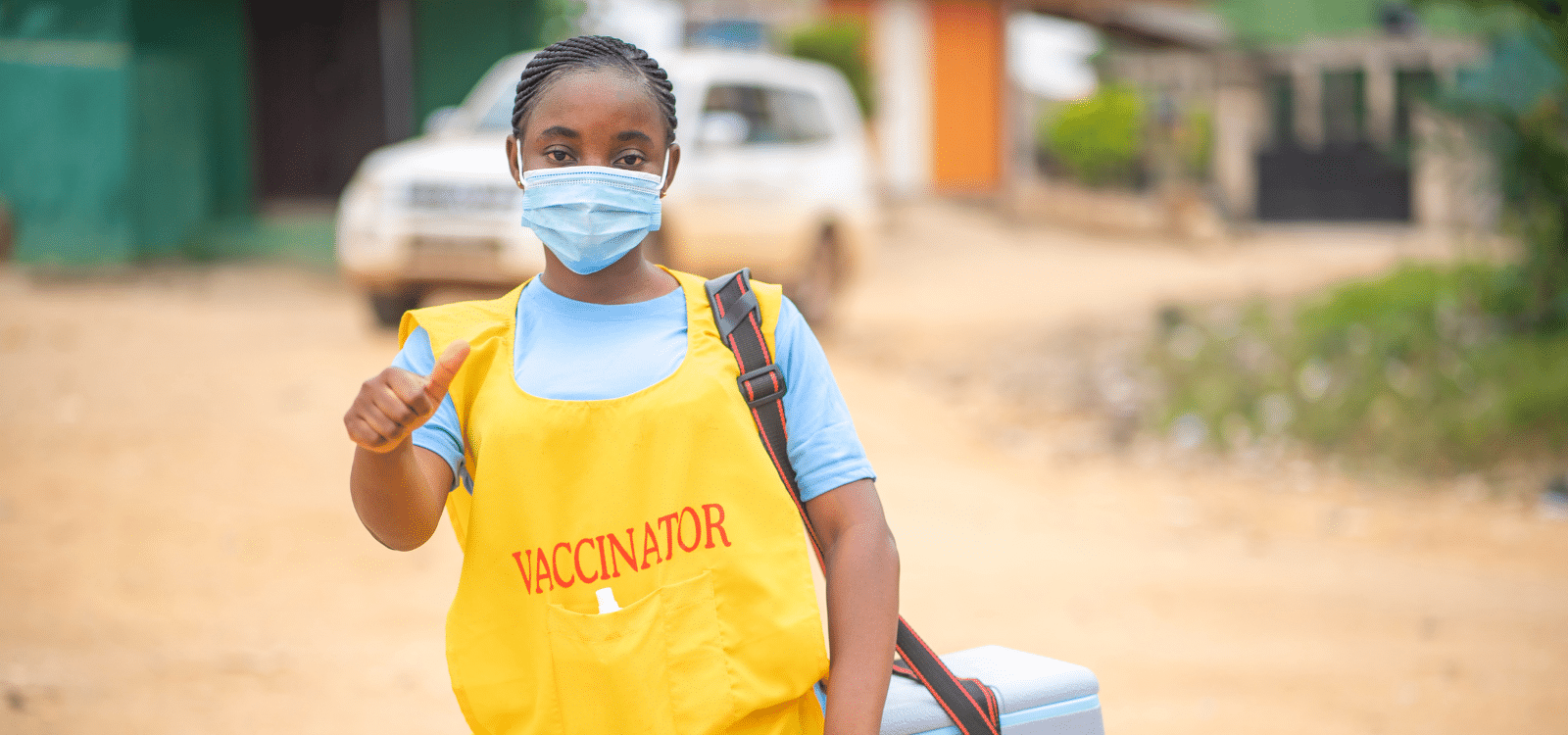
With the logistics and financial resources of a country-wide census not available, as well as the critical need to roll out the vaccine campaign in a time sensitive manner, Tracy and her team used geospatial data to model population dynamics to develop high-resolution population estimates and infrastructural data for Nigeria and a number of other countries. The purpose of this data was to identify where people were living in the country to provide evidence-based data for informed decision making in vaccination campaign programs.
The data sets developed were introduced into a vaccination tracking system which enabled health workers delivering the vaccine to plot target areas and use the population estimates to identify children below 5-years of age eligible for the vaccine.
Built to last
Having worked in NGOs for most of her career, Tracy is passionate about ensuring that projects can continue when the funding stops, learning from her own early experiences, following her CSC funded master’s study.
“The whole idea of doing such projects, like the GRID3 project then, was to ensure that it is sustainable, even if funding stops, as most projects aren’t funded forever.”
Working on the GRID3 project, Tracy sought ways to ensure all country-based stakeholders and collaborators were able to build their skills and capacity to continue the work once the project ended. With her team members, a Learning Management System (LMS) was developed. This enabled staff from government agencies and local NGOs to access geospatial training courses to acquire knowledge and skills on geospatial data analysis and mapping. The LMS was well received, with countries reporting significant improvement in their day to day activities, especially in mapping for health and demographic survey projects.
The team were also able to develop several additional tools to use the data sets created for other purposes. This included a tool to determine where to build new infrastructure, such as schools and hospitals, based on existing infrastructure data and population estimates. This tool has application to budget forecasting and allocation and Tracy delivered training and workshops in Nigeria to budget ministers and those responsible for national planning.
At the operational level, a further lasting impact of Tracy’s work was the collaboration she instigated with the National Space Research and Development Agency (NASRDA) of Nigeria. Her local knowledge of the expertise of the institute ensured they were included as a core stakeholder and that staff were briefed and trained on how to use the data sets produced. Working with NASRDA, they developed a geospatial portal to hold the geospatial infrastructure and demographic data gathered and continue to use the data sets and tools in future work.
Not all the countries she worked with had similar departments, however she is pleased to report that the capacities of the relevant departments or agencies identified have been improved through the introduction of geospatial data and analysis to inform planning and decision making.
“[T]hese national agencies, like the National Bureau of Statistics (NBS), now have strengthened capacity to conduct geospatial analysis that can inform government decisions on how to plan and distribute resources accordingly and more efficiently.”
Data for environmental sustainability
Whilst working with GRID3, Tracy developed connections with different partners and stakeholders, which led her to finding out about the Socio-Ethical Development and Environmental Risk Awareness Initiative (SEDERA), of which she is now Technical Director. Here, she leads on the development and implementation of data driven technical projects on environmental sustainability, aimed at addressing the challenges threatening Nigeria’s commitment to meet the Sustainable Development Goals (SDGs).
Environmental sustainability is a cause that is close to home for Tracy.
“I’m from the Niger Delta in Nigeria where I’ve seen the impact, the devastating negative impacts of oil and gas exploration and exploitation activities.”
During her undergraduate degree in microbiology, Tracy was introduced to the field of environmental microbiology and became interested in the use of microbes in responding to oil spills. This inspired her to pursue her first Commonwealth Scholarship at the University of East Anglia, where she completed an MSc in Environmental Assessment and Management. During this master’s she was exposed to Geography Information Systems and Remote Sensing and learned how this can be applied to assess and respond to environmental issues, such as oil spills and gas flaring in the Niger Delta.

Following her master’s, she returned to Nigeria and found immediate application for her skills in using GIS and remote sensing to inform responses to oil spills, instructing those on ground where to deploy their resources.
“The microbiology aspect of you going to do the remediation work itself on the ground, in the field, that’s not where my skills took me. It took me to the aspect where you now have to do mapping and geospatial analysis to help inform how you can now actually send those people on the ground to exact locations to do the actual work itself.”
Through her work with SEDERA, Tracy is continuing to apply her skills to respond to and safeguard against environmental risks. In a recent project, Tracy focused her attention on both the environment and supporting youth in the Niger Delta. Using data to identify areas of critical youth unemployment, Tracy developed a sustainable technical waste management project, funded by TrustAfrica. Through the project, 40 unemployed youth were trained in technical waste management and then deployed in locations with high waste management issues. For waste management companies, the project provided ready trained employees, and for the participants, an opportunity to build their skills and capacity for a growing and important environmental role.
Looking to the future
Alongside her work at SEDERA, Tracy is a Physical Geography Instructor at Coquitlam College in Vancouver, Canada. Here, she teaches students how to investigate physical ecosystems and the relationship between humans and planet Earth. Understanding this relationship and the geography around us is something Tracy believes needs to be better instilled in people from a young age, in both developed and developing countries, to address climate change. Looking to the future, she hopes to expand her work in this area and develop programs to teach children about their environment and the need to protect it.
“You know what’s so interesting about it, is that it’s something you see every day around you, and you get to learn the complexity of how it functions… And this would help people get a better understanding on the issues surrounding climate change because it’s all related, and the need to work on achieving the sustainable goals.”
Tracy Adole is a 2010 and 2014 Commonwealth Scholar from Nigeria. She studied for an MSc in Environmental Assessment and Management at the University of East Anglia and a PhD in Geography at the University of Southampton.